July 21, 2006Lebanon War in Google EarthStumbled on this today, via Ogle Earth. Børre Ludvigsen's Al Mashriq website has KMZ files with Google Earth locations for many of the newsworthy events of the current conflict in Lebanon.... You can see the difference, for example, in the intensity of the farming on either side of the Israel-Lebanon border, the differences in architecture and level of development, and the incredible proximity of the towns to the border. And overlaying the news events of the week on the map gives you a sense of the scale and scope of the conflict, down to the individual road, farm, and house. 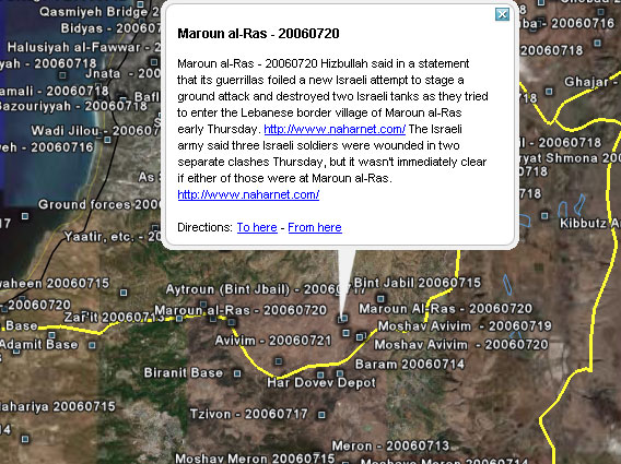 Comments
Post a comment
|
| Copyright 2006 © David Bau. All Rights Reserved. |