November 01, 2006Flood Maps
And, of course, the information is right there on the FEMA web site. FEMA flood maps can be browsed here at the FEMA Map Service Center. They are pretty interesting. And they are totally free. To compute flood lines, FEMA estimates the BFE around each body of water. That stands for "Base Flood Elevation" - it is the estimated high water mark that occurs with 1% probability in a year. If the stream near your house is normally at 115 feet, it might have a BFE of 122 feet. If your house is below that elevation, you should not be surprised when you find yourself underwater before your mortgage is up. Google Earth gives nice elevation data superimposed on satellite images, so you can see how high your house is. I wonder how accurate it is. Posted by David at November 1, 2006 09:35 AMComments
Post a comment
|
| Copyright 2006 © David Bau. All Rights Reserved. |
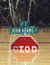 For a few years, Heidi and I have been looking for a new house. We recently saw a property near some water and thought, "I wonder if it floods." When an architect friend informed me that Town Hall should have FEMA flood maps, my first thought was to try to save a trip to Town Hall and look for the FEMA data on the internet.